Showing posts with label rock. Show all posts

Saturday, November 20, 2010

It's full moon again--at 12:04 a.m. Now where did I leave off? I'm going to have to backtrack...

Head of the Path, Another Take, July 24, 2010
Copyright © 2010 Paul D. Natkin, All Rights Reserved

Thursday, November 4, 2010

Well, time again for the Viewpoint.

Faucet and Rock, Fall, 2010
Copyright © 2010 Paul D. Natkin, All Rights Reserved

Sunday, September 19, 2010

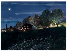
In the dark, the rock at the head of the path is dappled with light and shadow. Put in another way, the light and shadow are distributed unevenly across its surface. You would not be able to predict, on the basis of a general understanding of what happens to an object in a dark environment where that object is illuminated from an angle, exactly which parts of the rock reflect light and which parts are in shadow. This confusing lighting situation is the result of multiple light sources and probably also the presence of one or more objects between these light sources and the rock which cast shadows onto its surface.

The Rock, July 24, 2010
Copyright © 2010 Paul D. Natkin, All Rights Reserved

Monday, December 28, 2009

This morning the sky was overcast, very different from how it was even yesterday, but especially three days ago.

Looking at the View, Dec. 25, 2009
Copyright © 2009 Paul D. Natkin, All Rights Reserved

Sunday, September 20, 2009

The Head of the Trail: A Second Version

Head of the Trail, Second Version
Copyright © 2009 Paul D. Natkin, All Rights Reserved

Friday, August 28, 2009

Twenty-three Stones

There are twenty-three stones at the Viewpoint. I counted them this morning. This includes the big rock at the head of the trail going down to the ravine. It also includes a mostly submerged rock nearby and a large, almost completely submerged stone near the south entrance and another stone close to the latter which lies flat on the ground and is partially submerged. This doesn't include the three concrete bollards that stand at the entrances: one at the north entrance and two at the south entrance. (There are two possibilities for entry at the south end, so two bollards were required to keep anyone from entering the park in a car, I suppose.) Another kind of stone I'm not including in this tally of twenty-three is type of stone used to support the lamp fixtures. There are three of these stones, if I remember correctly. They're basically blocks of concrete. Their size differs from lamp to lamp. As I counted, I found myself wondering what the difference really is between a rock and a stone. There are many things I might call either "rock" or "stone," but it seems to me that if something is actually made of cement, or concrete, it shouldn't be called a rock. I think of a "rock" as something formed by the forces of nature. We often speak of "headstones" in reference to the markers in cemeteries. Many of these are made of marble, granite or other kinds of rock, but if I'm not mistaken, some are made of cement, or concrete, and still we call them "stones." Many of the "stones" at the Viewpoint are, in fact, pieces of cement or concrete. Maybe later I'll give more details about their composition. I could check my photos, so that I don't have to go to the Viewpoint a second time today, but it's hard to tell much about a stone's composition from a photo, unless the photographer has made a point of focusing on the stone. I do have lots of close-up photographs of plants and animals that live in the park, but none of rocks, as I recall.

Next time I go to the Viewpoint I'll count the hawthorns that line the side of the park adjacent to the arterial. These are some of the last hawthorns on the hill. One was recently lost.

Wednesday, August 26, 2009

The Shortcut

Last night I looked at the edge in the dark; today I looked at it in the day. The question is which way I can remember it best. When it's dark, the edge is clearly delineated from the space beyond it. The edge is illuminated; the space is not. But in the daytime, I can see more about what's going on with the edge as it curves around the hillside than I can at night. For instance, roughly six feet to the southwest of the Sentinel, there's a stretch of bare earth going down from the edge to the trail below. This stretch of bare earth is an unofficial trail, formed by the clambering feet of all the people who have chosen to take a shortcut from the park to the official trail, instead of walking to the end of the park, where the rock marks the official beginning of the trail. I remember at least once or twice taking photos of someone scrambling up this unofficial trail--or tearing down it. There are two large exposed tree roots that form "stairs" on this shortcut, as well as a third that sticks out at a funny angle at the bottom. At night you don't see the shortcut at all, but it's an important marker of distance in the curve as it wraps around the hill. One more thing I should mention: the greatest degree of curvature occurs on the other side of the Sentinel, in the direction of the adjacent street. I've taken a lot of photos to document this. It's a simple, humble curve--like a simple, humble song.